Independent practice site — not affiliated with Immigration, Refugees and Citizenship Canada or the Government of Canada. The official study guide is free on Canada.ca.
Travel across Canada’s five regions. Learn which provinces and territories belong to each one, where their capitals are, and how land and water shape life there.
This independent lesson is a study aid. Discover Canada is the free official guide.
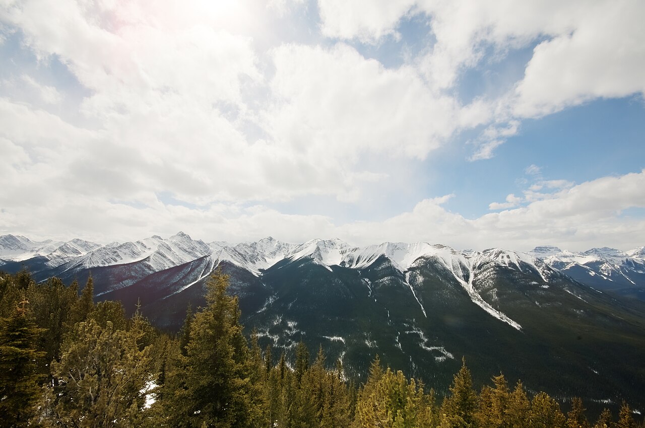
CANADA ATLAS · THE ROCKIESMountain landscape in Banff, Alberta. Banff is in Alberta, one of the Prairie Provinces; the province also reaches into the Rocky Mountains.Banff landscape.jpeg · Scott Webb · Wikimedia Commons · CC0 1.0 · Resized from the original; cropped by this layout
Atlantic Provinces
In plain language
Newfoundland and Labrador, Prince Edward Island, Nova Scotia and New Brunswick face the Atlantic. Fishing, farming, forestry and other natural resources have shaped the region.
Picture it
Picture the Atlantic coast: Nova Scotia’s Halifax is a major port, while Prince Edward Island is known for its red soil and potato farming.
Ask yourself
Name the four Atlantic provinces. Which one has Fredericton as its capital?
Central Canada
In plain language
Quebec and Ontario form Central Canada. Many communities lie along the St. Lawrence River and Great Lakes. Manufacturing and services are important here.
Picture it
Ottawa is Canada’s national capital in Ontario. Toronto is Ontario’s provincial capital; Québec City is Quebec’s provincial capital.
Ask yourself
What is the difference between Ottawa and Toronto as capitals?
Prairie Provinces
In plain language
Manitoba, Saskatchewan and Alberta are the Prairie Provinces. Farmland, energy and minerals are important, though the region also includes forests, cities and mountains.
Picture it
Saskatchewan grows grain and oilseeds; Alberta has oil, gas, cattle ranches and the Rocky Mountains.
Ask yourself
Match Winnipeg, Regina and Edmonton to the three Prairie provinces.
West Coast
In plain language
British Columbia is the West Coast region on the Pacific Ocean. Mountains, forests, fishing and Pacific trade are notable parts of its geography and economy.
Picture it
Vancouver is a major port, but Victoria is British Columbia’s provincial capital.
Ask yourself
Which city is the capital of British Columbia: Vancouver or Victoria?
Northern Territories
In plain language
Yukon, the Northwest Territories and Nunavut are territories, not provinces. The North includes tundra, mountains and long seasonal changes in daylight. Mining and Inuit art are among activities described in the guide.
Picture it
Whitehorse is in Yukon, Yellowknife in the Northwest Territories, and Iqaluit in Nunavut.
Ask yourself
Which northern capital belongs to Nunavut?
NORTH, THEN WEST TO EAST
An atlas of the five regions
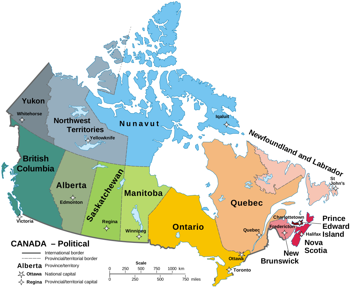
Schematic atlas: the blocks show the groups to remember, not borders or distances to scale.
Locate the three territories across the north and the provinces from the Pacific coast through the Prairies and Central Canada to the Atlantic coast.Political map of Canada · Hogweard · Wikimedia Commons · Public domain · Original SVG, resized by the page layout
01
Northern Territories
Yukon · Northwest Territories · Nunavut
02
West Coast
British Columbia
03
Prairie Provinces
Manitoba · Saskatchewan · Alberta
04
Central Canada
Quebec · Ontario
05
Atlantic Provinces
Newfoundland and Labrador · Prince Edward Island · Nova Scotia · New Brunswick
Ten provinces, three territories. Ottawa, in Ontario, is the national capital; the 13 provincial and territorial capitals are listed below.
Match each province or territory to its capital
Read each row by region. Cover the last column to quiz yourself.
Five regions and 13 provincial or territorial capitals
Region
Province or territory
Capital
Atlantic Provinces
Newfoundland and Labrador
St. John’s
Atlantic Provinces
Prince Edward Island
Charlottetown
Atlantic Provinces
Nova Scotia
Halifax
Atlantic Provinces
New Brunswick
Fredericton
Central Canada
Quebec
Québec City
Central Canada
Ontario
Toronto
Prairie Provinces
Manitoba
Winnipeg
Prairie Provinces
Saskatchewan
Regina
Prairie Provinces
Alberta
Edmonton
West Coast
British Columbia
Victoria
Northern Territories
Yukon
Whitehorse
Northern Territories
Northwest Territories
Yellowknife
Northern Territories
Nunavut
Iqaluit
National capital: Ottawa (in Ontario).
A way to remember
Move from east to west, then north: Atlantic (4 provinces) → Central (2) → Prairies (3) → West Coast (1) → Northern Territories (3). That adds up to 10 provinces and 3 territories. Ottawa is the national capital; the table below gives each provincial or territorial capital.
Check your understanding
Is Ottawa the capital of Ontario?
No. Ottawa is the national capital, located in Ontario. Toronto is the capital of Ontario.
Which province has Victoria as its capital?
British Columbia. Vancouver is a major city and port, but Victoria is the provincial capital.
What are the three northern capitals?
Whitehorse is the capital of Yukon, Yellowknife of the Northwest Territories, and Iqaluit of Nunavut.
Help us improve this site with Firebase Analytics. We send page visits, broad diagnostic milestones and confirmed paid study purchases only if you agree. Privacy Policy